

Map
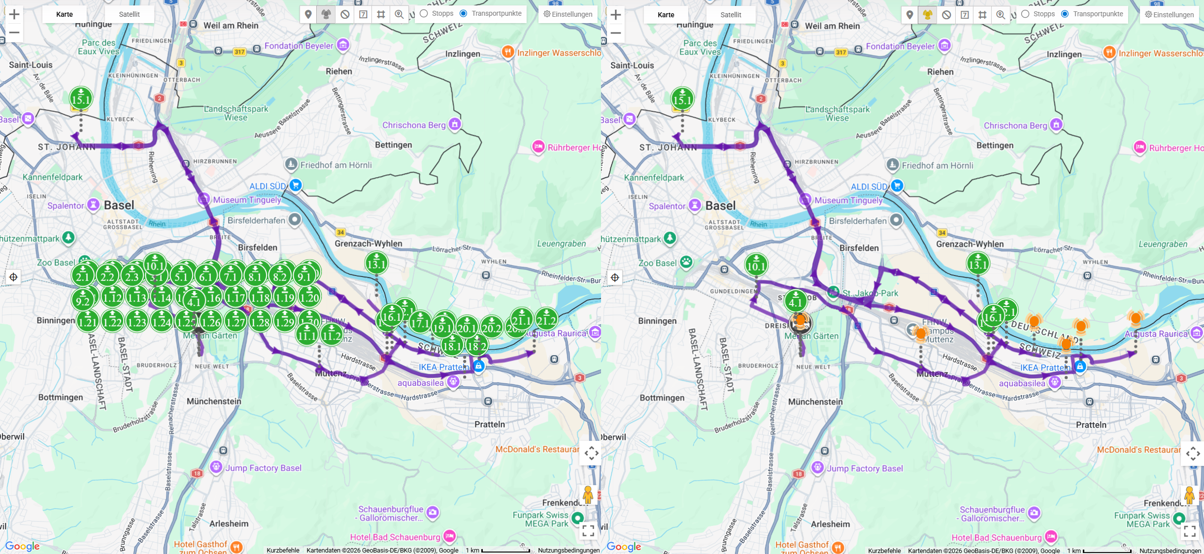
Map view in Monitoring: vehicles, tours and shipment points in real time.
The monitoring map shows you the current status of all active tours and vehicles in real time (an administrator sets the tour refresh interval per group under Settings › Map). You can track vehicle positions, tour routes, shipment points and stops on an interactive map. Google Maps (default) and PTV are available as map providers (configurable in Map Settings).
Map Elements
The following elements are visible on the map:
Vehicles
Each active vehicle is displayed as an icon on the map. The Vehicle label type setting determines whether the icon shows the full name (Full name), the short name (Short name) or no label (Hidden). Optionally, a line with the trailer (Show trailer label) and a line with the driver (Driver) are shown as well; you set both in Map Settings. Each vehicle is displayed in its own monitoring colour.
Tour Routes
The planned routes of active tours are drawn as lines on the map. Each tour gets its own colour from a fixed colour palette; the tour line and the stops of a tour have the same colour. If Show stop status is switched on in Map Settings, the markers are shown in the status colours instead.
Transport Points
Loading and unloading points of shipments are displayed as markers. Which transport points are visible is set in Map Settings with Display locations: All, Relevant, Pickup or Dropoff.
Stops
Planned and already completed stops of the tours are marked on the map.
POI
Points of Interest (POI) can be displayed by category. The visible categories are selected in Map Settings.
Clusters
Use the Cluster button at the top right of the map to switch the grouping of markers on or off. The function is switched off by default; when it is active, the button is highlighted. The setting is saved per user.
Only markers at exactly the same coordinate are grouped – markers that are close to each other remain visible individually. Clicking a cluster icon expands or collapses the group; the map does not zoom. With Ctrl+click (Mac: Cmd+click) you select all points of the group.
Marker Interaction
Stops and Transport Points
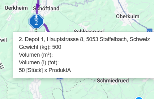
When you move the mouse over a stop or transport point, a small info card appears with a header, location, times and specialities. A click does not open an info window but selects the point:
- The map pans and zooms to the point (it only zooms in, never out). If Fix zoom is switched on, the map view stays unchanged.
- If the stop has exactly one transport point, the details of this transport point open to the left of the map (with Shipment Review active, the action Mark as reviewed for Shipment Review is also available there, depending on the status of the transport point). If the stop combines several transport points, it is only highlighted.
- An open vehicle card is closed.
When you close the details, the map shows the whole tour again. There is no longer a separate button for focusing the point on the map – selecting the point already focuses the map.
Vehicles
Clicking a vehicle opens the Vehicle card with photo, License Plate, Trailer, Driver, Tour and Notes. Users with chat permission also see the Message button. The card closes via the X, by clicking the same vehicle again, by clicking an empty spot on the map or by clicking a stop.
Map Functions
Controls
The following controls are available on the map:
| Position | Control | Function |
|---|---|---|
| Top left | Zoom buttons (+ / −) | Zoom the map in or out |
| Top left | Map | Satellite | Switch between road map and satellite image. When you move the mouse over the active option, you can show or hide Terrain on the road map and Labels on the satellite image. If the map provider offers no satellite image, the switch is not shown. |
| Top right | Clear map | Reset the map |
| Top right | Cluster | Group markers at the same coordinate (see Clusters) |
| Top right | Find location | Search for a location on the map |
| Bottom right | Full screen | Show the map in full-screen mode; also remains visible in Street View |
The gear icon next to the map opens the Map settings (see Map Settings). While Street View is open, the gear icon is hidden.
Location Search
Using the search field on the map, you can enter an address or location. The map centres on the found result.
Zoom
Use the zoom buttons or the scroll wheel to zoom in and out. When you select a point, the map automatically zooms to it. If you switch on Fix zoom in Map Settings, the map no longer moves by itself; the actions Center and Trace still fit the view to the tour. Fix zoom is switched off by default.
GPS Trace
The GPS trace allows the recorded route of a vehicle to be displayed as a line on the map. You switch the trace on and off with the Trace action in the tour detail area. While the trace is shown, the planned tour line is hidden. Position markers are drawn along the trace at 5-minute intervals; you can move the mouse over them. Use Center to fit the map view to the tour.
Automatic Update
The map updates automatically – no manual action is required. Vehicle positions are transmitted live and continuously. The tours are reloaded at a fixed interval; an administrator sets this interval per group under Settings › Map (default 20 seconds, 15 to 28,800 seconds possible). The interval cannot be set in the Monitoring Map Settings.